
Fellow Boaters, Interestingly, the current Google Earth satellite photos of the Great Salt Lake and vicinity were taken just about 1 year ago (6/20/15) when the lake’s surface elevation was almost exactly the same as today’s elevation (4194.3’ vs. 4194.2’ today). A lot of the lakeshore and lakebed features are prominent in the photos, such as Eardly Spit, Miera Spit, Goggins Reef, etc. This time of year is the peak of lake clarity (thanks, little brine shrimp) so a lot of lakebed features can be seen. Bry Pratt

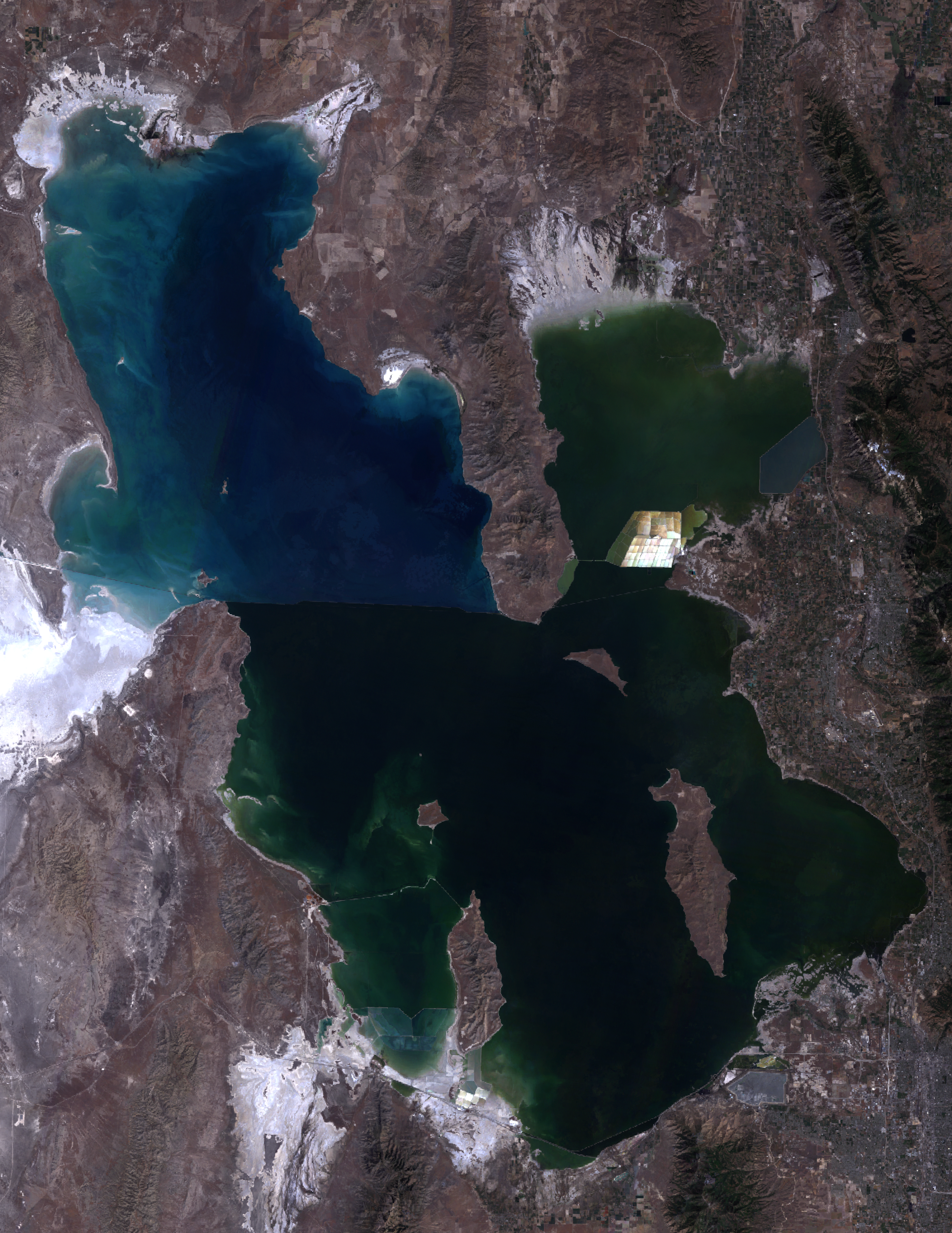
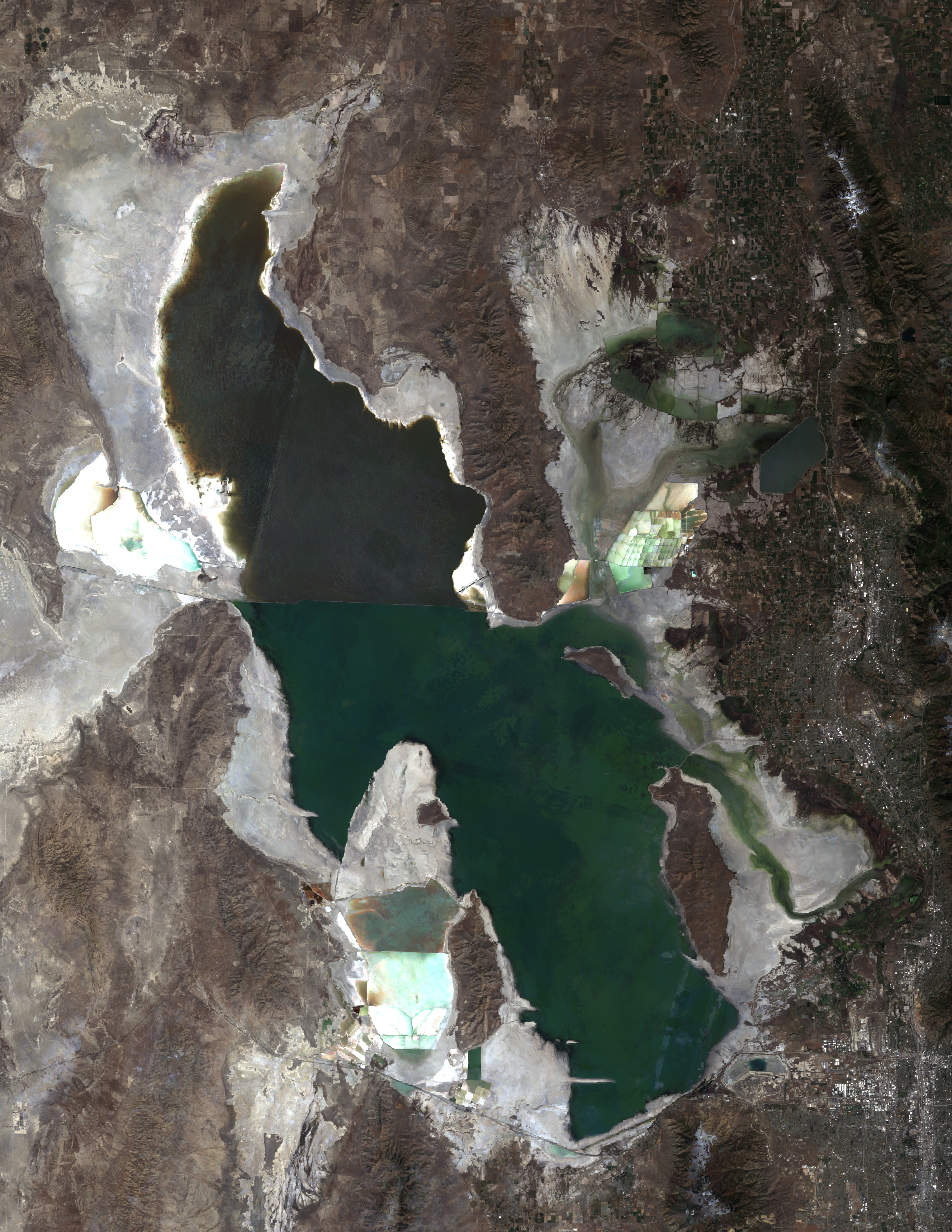
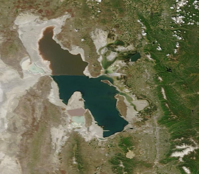
In response to Bry's comment about the Google imagery for the GSL: I have recently done some remote sensing analysis on the lake for my Master's degree, attached you will find imagery for the lake levels in 2015 and 1988 respectively. The third image was taken by a satellite yesterday morning, it may look a little different due to resolution/projection differences. Amazing how much our lake changes over the years! Cheers, -Adam [image: Inline image 1] [image: Inline image 3] [image: Inline image 4] On Mon, Jun 6, 2016 at 12:35 PM, B.T.Pratt <btpratt@infowest.com> wrote:
Fellow Boaters,
Interestingly, the current Google Earth satellite photos of the Great Salt Lake and vicinity were taken just about 1 year ago (6/20/15) when the lake’s surface elevation was almost exactly the same as today’s elevation (4194.3’ vs. 4194.2’ today). A lot of the lakeshore and lakebed features are prominent in the photos, such as Eardly Spit, Miera Spit, Goggins Reef, etc. This time of year is the peak of lake clarity (thanks, little brine shrimp) so a lot of lakebed features can be seen.
Bry Pratt
_______________________________________________ GSL-Marina mailing list GSL-Marina@mailman.xmission.com https://mailman.xmission.com/cgi-bin/mailman/listinfo/gsl-marina
participants (2)
-
 Adam Clark
 -
 B.T.Pratt